NJ weather: From 30s to 80s, a wild temperature forecast
The Bottom Line
This week's weather sure has been gorgeous so far. Mainly bright skies, temperatures in the 60s and 70s, and very little rain. It has been a nice change of pace from the rest of April so far, which was pretty cool and unsettled.
Change is in the air on this Thursday morning, as colder air returns to New Jersey. Our weather still looks reasonably pleasant and mainly dry to end the workweek. Just cooler.
There are two weather stories for the upcoming weekend. First is a chance of rain, centered on the "Saturday PM" hours. Second is a big warmup, into the 70s and 80s by next week.

Thursday
Thursday morning is cool, although not quite as cold as expected. (Due to lingering clouds and a little breeze.) Temperatures are mainly in the 40s across the state, with a cool breeze affirming it is a "jacket weather" kind of morning.
You will really notice the temperature difference Thursday afternoon, as high temperatures only reach the lower to mid 50s. That is a far cry from Wednesdays near-70 degree temps. And it will make it feel more like late March than late April.
It will still look like a nice day, with sunshine winning out to the north and scattered clouds hanging on in South Jersey. The chance of a stray sprinkle to the south is not zero.
Thursday night looks cold. And potentially frost for much of New Jersey. Lows will average mid 30s. A bit colder in NW NJ and the Pine Barrens, where an outright freeze is possible. Somewhat warmer in cities and along the coast, but still pretty chilly, near 40.
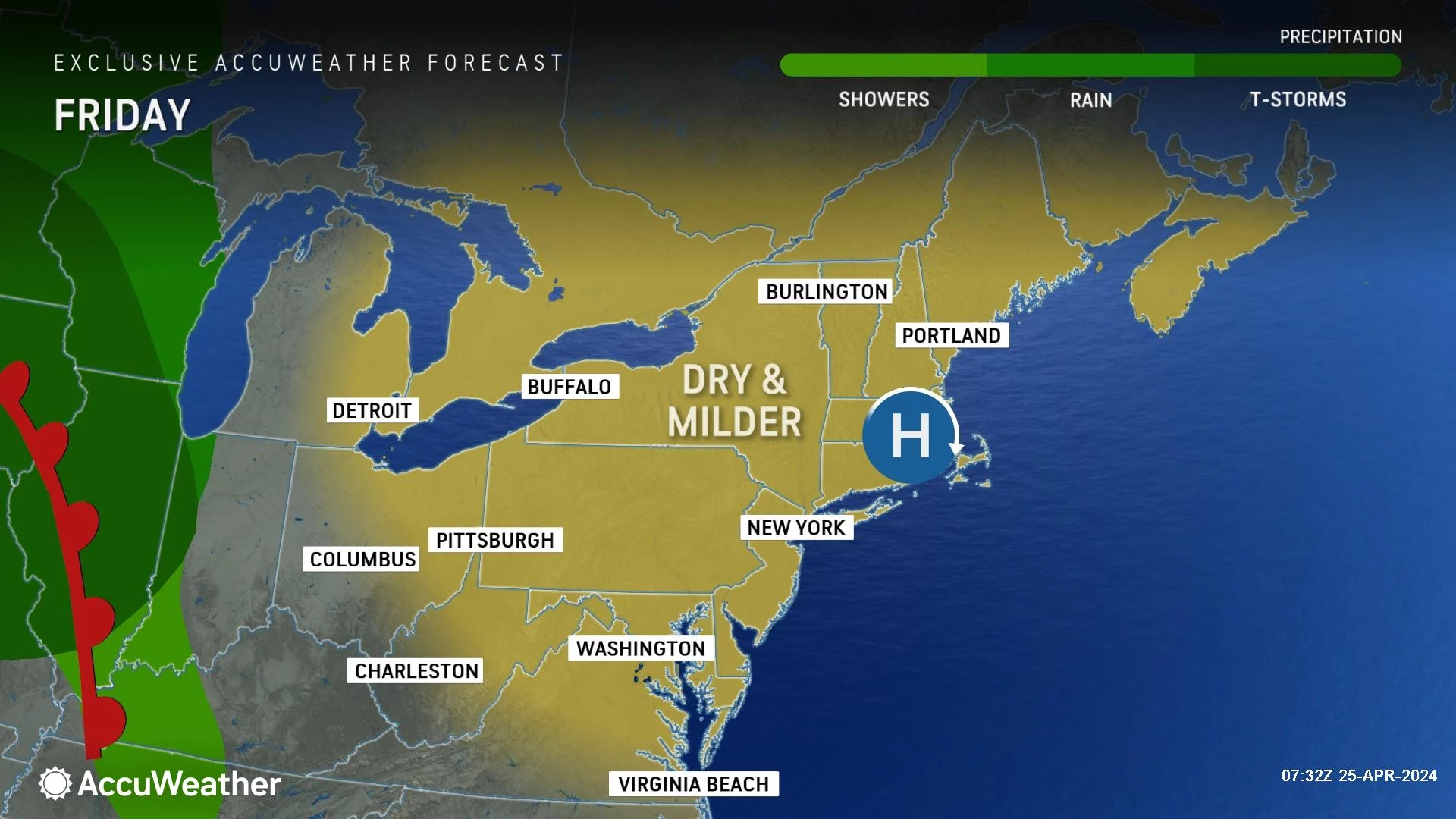
Friday
Another nice day. Although I would like to see temperatures a few degrees higher.
Look for highs in the upper 50s to around 60 degrees, with abundant sunshine and completely dry weather. A light on-shore breeze will keep the Jersey Shore the cool spot in the state, closer to 50 degrees.
Friday night will be the last chilly night in this sequence. (And possibly the last frost of the season for many?) Low temperatures will likely dip below 40 degrees across inland NJ.
Saturday
The forecast for the final weekend of April is ... OK. There will be some gray skies and raindrops to dodge.
Saturday morning should stay dry, with decreasing peeks of sun.
Clouds will take over as rain chances start ramping up Saturday afternoon into the evening, as a warm front lifts toward New Jersey. It looks like rain will take the form of scattered showers — generally hit-or-miss stuff, light in intensity. Everyone in NJ may get wet at some point late Saturday. But total rainfall will likely be limited to a tenth of an inch or two.
Sunday
Sunday may still feel unsettled, with mixed clouds and sun. You may even feel a hint of humidity in the air. There is a chance of a shower, especially early (lingering from Saturday) and late (of the popup thunderstorm variety). But Sunday's overall rain chance is so low, I have opted against a "rain" icon on the 5 Day Forecast.
Sunday starts the big warmup, with high temperatures shooting into the lower 70s for most of the state. As you would expect, the coast and northwest hills will end up cooler.
The Extended Forecast
Thermometers really get cooking Monday, Tuesday, and Wednesday, which could be a three-day stretch of 80+ degree temperatures.
It will not be a perfect representation of summertime warmth, however. The coast will likely end up much cooler, in the 60s, influenced by the chilly ocean and bay water. And there will be a daily chance of a popup shower or thunderstorm. Best chance for more widespread rain activity looks to be late-day Tuesday.
A late-week cold front, around next Thursday, will push through a widespread batch of rain and send temperatures tumbling again.
Best SAT scores in every NJ county
Gallery Credit: Dino Flammia/Sergio Bichao
Dan Zarrow is Chief Meteorologist for Townsquare Media New Jersey. Follow him on Facebook for the latest forecast and realtime weather updates.
Worst 30 public schools in New Jersey
Gallery Credit: Rick Rickman
More From 94.5 PST