NJ heat wave ends with a bang Later Monday, with strong storms and heavy rain
Feeling "well done" after this weekend of ferocious heat and humidity? I could find four weather stations that hit triple-digits on Sunday: Point Pleasant (101°), Sea Girt (101°), Seaside Heights (101°), and Atlantic City International Airport in Egg Harbor Township (100°, breaking the record from 1981).
Yes, it was hotter along the coast!
Our heatwave ends on Monday ... eventually.
The day will start with sunshine and some fog, with a stray shower or thunderstorm possible. It's still going to be a steamy summer day, with temperatures mainly in the 70s Monday morning.
High temps will range from the lower 80s in North Jersey to the lower 90s in South Jersey. The heat index ("feels like" or "apparent" temperature) could reach 100+ degrees for another day.
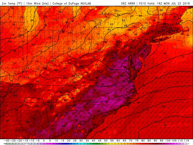
A Heat Advisory continues for our area until 7 pm.
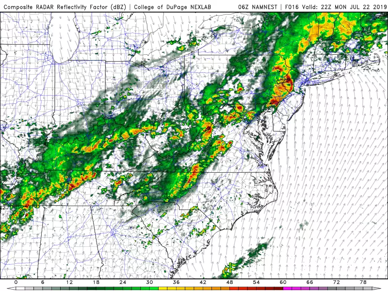
Then a cold front will spark a line of strong to severe thunderstorms will arrive sometime later Monday. (You might say our extreme heatwave will end with a bang.)

Forecast models do show some variations in storm timing. The "main event" squall line could push into NW NJ as early as Noon or 1 p.m. On the flip side of the state, the southern coast may remain storm-free until as late as 7 or 8 p.m.
Given our trio of hot, humid days, it should be no surprise that these thunderstorms will reach severe limits. Very heavy rain is practically a guarantee, with 1 to 2 inches widespread and 3 to 4+ inches locally. A Flash Flood Watch has been issued for all 21 counties in New Jersey through Tuesday morning.
Damaging 70 mph winds, frequent lightning, hail, and an isolated tornado can't be ruled out through Monday evening. A familiar story over the past two months. Bottom line: It's going to be a stormy night.
Tuesday is looking pretty soggy too, with periods of rain pretty much all day. At least the rain, clouds, and cooler air mass will keep temperatures at bay. No more 90s! Highs will only reach the mid 70s, at best, Tuesday afternoon.
Final showers should exit the Garden State early Wednesday morning, as the door opens to (somewhat) less humid air. (I wouldn't call it dry, but dew points scaling back from the 70s to about 60 should be a welcome change of pace.) I'm not entirely sure skies will become sunny, but the day should become brighter. High temps will be pleasant and below-normal once again, in the lower 80s.
More From 94.5 PST