
Here comes Tropical Storm Elsa: 1-3″ of rain, 30-50 mph wind gusts for NJ
UPDATE as of 6 p.m. Thursday...
The northernmost band of Tropical Storm Elsa is now lapping up against South Jersey. Meanwhile, severe thunderstorms continue to soak and rattle North Jersey.
It will take a while for Elsa's impacts to ramp up. Remember, the brunt of the storm - the heaviest rain and strongest wind - is coming late tonight, after about Midnight.
UPDATE as of 3 p.m. Thursday...
A Severe Thunderstorm Watch has been issued for the 13 counties in the northern half of New Jersey until 9 p.m. Strong soaking storms have been popping up this afternoon, and may contain both severe wind gusts and hail.
To be clear, this "appetizer round" of thunderstorms is not directly related to Tropical Storm Elsa.
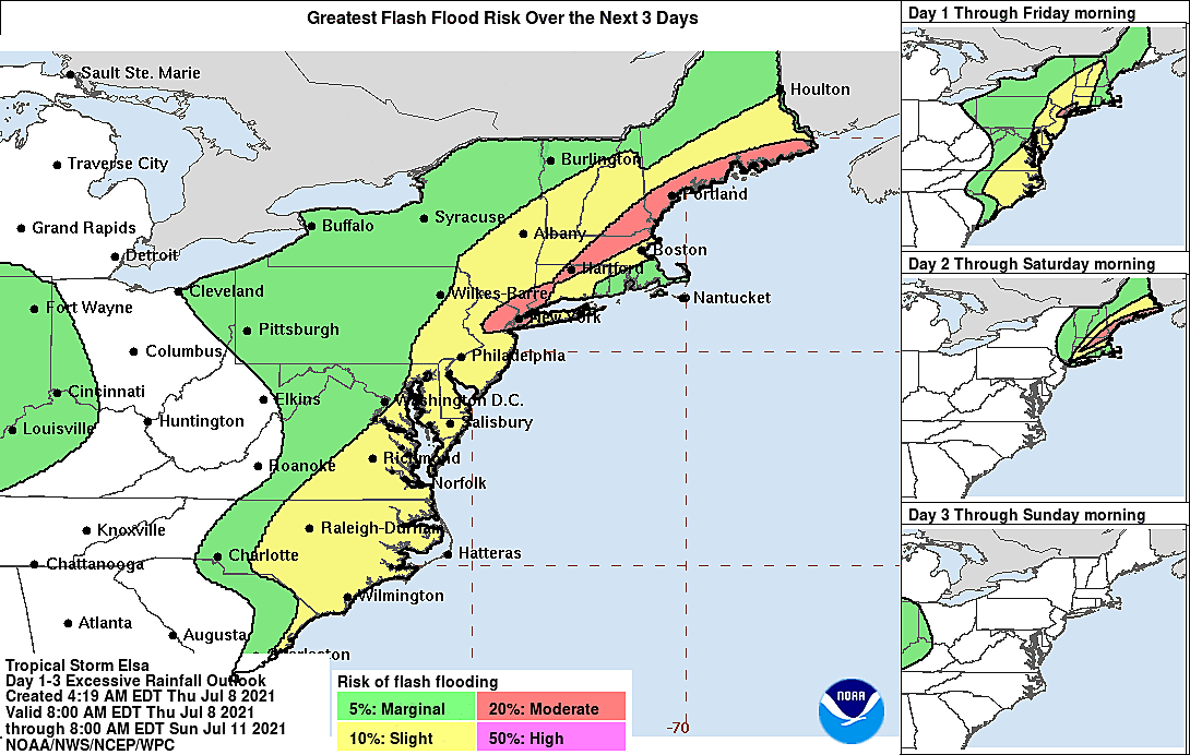
Meanwhile, concern is growing about the flash flooding potential when Elsa does arrive Thursday night. (It's becoming very clear this will be Elsa's biggest impact here in the Garden State.)
Antecedent ground conditions are quite wet, especially across northern and eastern NJ. That means it won't take much heavy rainfall to cause low-lying and poor-drainage areas to flood. There could be serious trouble along roadways and vulnerable streams and rivers by Friday morning.
Remember to never attempt to walk, drive, or swim through flooded areas. The depth and movement of flash flooding can be surprising and incredibly dangerous.
ORIGINAL POST from 6:56 a.m. Thursday...
The Bottom Line
There are lots of dramatic headlines and predictions being thrown around. And Elsa's worst-case scenario would be pretty bad for New Jersey, with tropical rainfall causing flash flooding and strong winds causing power outages.
However, for most of the state, I still believe that the most reasonable scenario still paints an "inclement and perhaps nasty" overnight. The southwesterly attack direction, the speed of motion, the overnight timing, and the (relative) weakness and disorganization of Elsa will help to mitigate the impacts of the storm.
Still, I think it's fair to call Elsa a significant weather event for the Garden State. So it's very important to be "weather aware" as Elsa approaches. The brunt of the storm is coming Thursday night.
Elsa's Journey Toward New Jersey
As of 5 a.m. Thursday, Elsa is centered over South Carolina. Over land, it has weakened to a minimal tropical storm, with sustained winds of 40 mph.

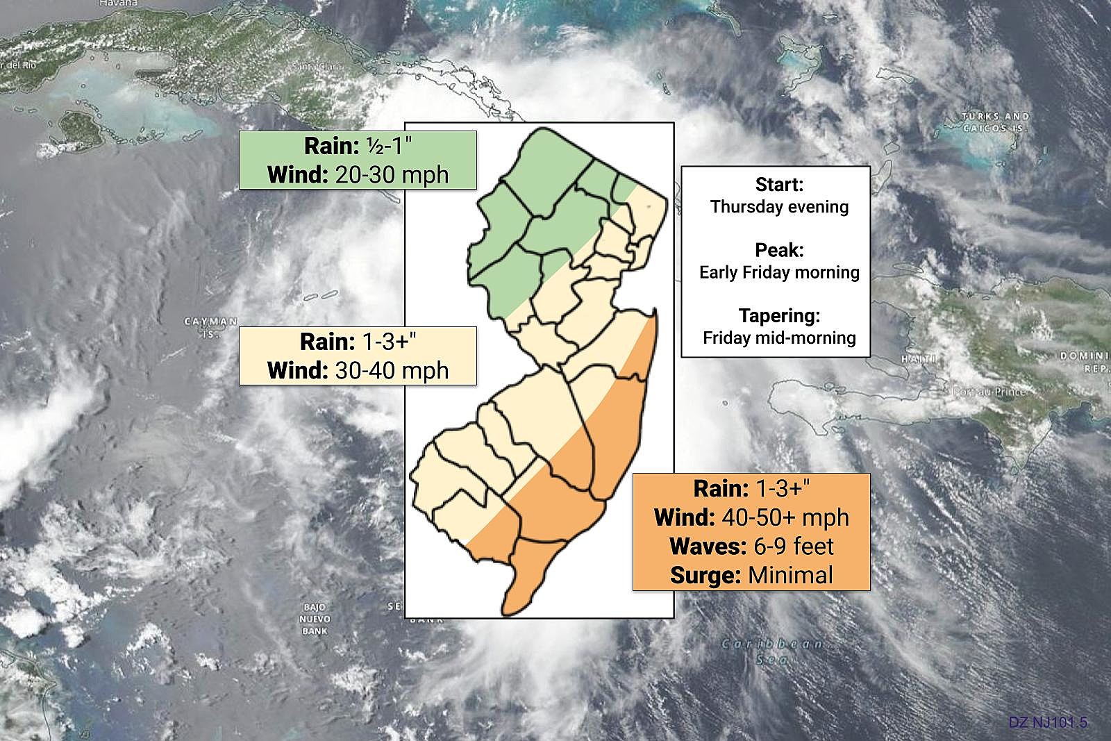
As Elsa passes through Virginia, Maryland, and Delaware later Thursday, it will start to suck up some warm ocean water. That will help the storm to get its act together a bit better, and strengthen slightly. The center of the storm (the "eye") will be directly over NJ's southern coast around 3-4 a.m. Friday
Big Concern #1: Rain
—Never underestimate tropical moisture.
—Most of the state will likely see an inch or two of total rainfall.
—If heavier bands of tropical rainfall set up and/or sit over one spot for an extended period of time, pockets of 3+ inches of rainfall can't be ruled out.
—Northwestern New Jersey is expected to fall out of Elsa's broadest rain shield, making it clearly the driest part of the state.
—A Flash Flood Watch has been issued for all 21 counties of New Jersey, from Thursday afternoon through Friday morning.
Big Concern #2: Wind
—Elsa's strongest winds will be found close to the center of the storm, which will parallel the coast late Thursday night. (In fact, we're going to end up on the western "weak" side of Elsa's circulation.)
—Top wind gusts of 40-50 mph are possible along the coast.
—Farther inland, gusts on the order of 30-40 mph are expected.
—Again, to the north and west, conditions will be tamer with gusts no higher than 30 mph.
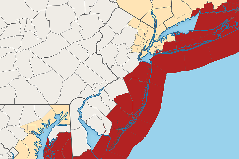
—A Tropical Storm Warning has been issued for the 5 counties along the Jersey Shore: Cape May, Atlantic, SE Burlington, Ocean, and Monmouth. Tropical storms and hurricanes are defined by their wind.
Little Concern #1: Coast
—Because Elsa is arriving from the southwest, not the ocean side, the storm surge and coastal flooding threat remains minimal.
—Having said that, because of the orientation of some tidal waterways (especially back bays), we could see up to a foot of water rise. Any coastal flooding issues should be very localized.
—Ocean waves will climb to about 6 to 9 feet during and after the storm, leading to moderate beach erosion and a high risk of rip currents up and down the Jersey Shore.
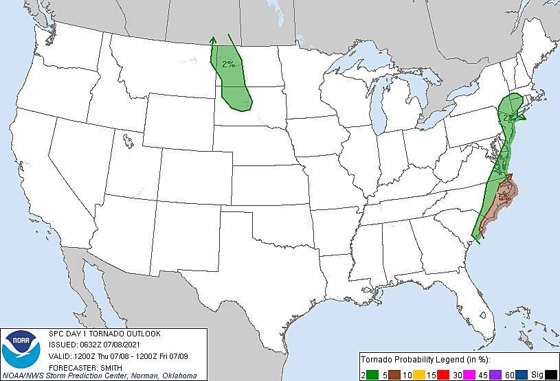
Little Concern #2: Tornadoes
—Tropical cyclones contain a lot of "twisting energy," especially close to the center of the storm. That increases the chance of tornadoes, embedded within the heavy rain and wind. (You may recall that was a significant problem during Isaias in 2020.)
—The chance for a tornado in New Jersey from Elsa is low, but not zero.
Timeline: Start, Brunt, End
—Thursday morning... Increasing clouds and sticky. High temperatures will reach about 85 to 90 degrees.
—Thursday afternoon... Scattered showers and thunderstorms will probably creep in, an unrelated precursor to Tropical Storm Elsa. Best chance of this rain will be in North Jersey.
—Thursday evening (5 p.m. to 11 p.m.)... Scattered rain from Elsa will start to bubble up from the southwest.
—Thursday night to early Friday morning (11 p.m. to 6 a.m.)... The brunt of the storm. Heaviest rain, strongest winds, and greatest tornado threat overnight.
—Friday morning (6 a.m. to 9 a.m.)... Still rainy and breezy. Temperature around 70.
—Friday late morning (9 a.m. to Noon)... Storm exits to the northeast. Rain tapers, wind calms, and skies start to clear.
—Friday afternoon and evening... Mostly sunny and warm, with highs in the lower to mid 80s. However, one more wave of (unrelated) showers and thunderstorms may sweep through New Jersey from late afternoon through early evening.
Storm Preps
As I suggested on Wednesday, the vast majority of New Jerseyans probably can and should do absolutely nothing to prepare for Tropical Storm Elsa.
Remember, the biggest concerns are 1.) heavy rain leading to flash flooding, and 2.) gusty wind leading to power outages. You might consider bringing in or securing lawn furniture and garbage cans. If you usually park your car in a low-lying area that floods in a typical rainstorm, you might want to move it. And keep your mobile devices charged in case the power goes out for a while.
Otherwise, be prepared to hunker down in a sturdy building Thursday night. You might be able to sleep right through the storm.
What's Next?
Saturday looks great, with sun and clouds, slightly reduced humidity, and highs in the lower to mid 80s.
Sunday could be a bit unsettled, with more cloud cover, a chance of a shower or thunderstorm, and a highs again in the 80s.
I have a feeling heat and humidity will return in the long-range forecast. There could be another heat wave in our future, with occasional thunderstorms too.
Please be smart and stay safe before, during, and after Tropical Storm Elsa drives through New Jersey. As always, we'll be here - on-air and online - with your latest news, weather, and traffic updates.
Dan Zarrow is Chief Meteorologist for Townsquare Media New Jersey. Follow him on Facebook or Twitter for the latest forecast and realtime weather updates.
Cape May, NJ: 15 wonderful places to visit
Gallery Credit: Erin Vogt
DID YOU KNOW: New Jersey has a volcano!
More From 94.5 PST


