Hey, Fay – Tropical Storm Warnings posted for the Jersey Shore
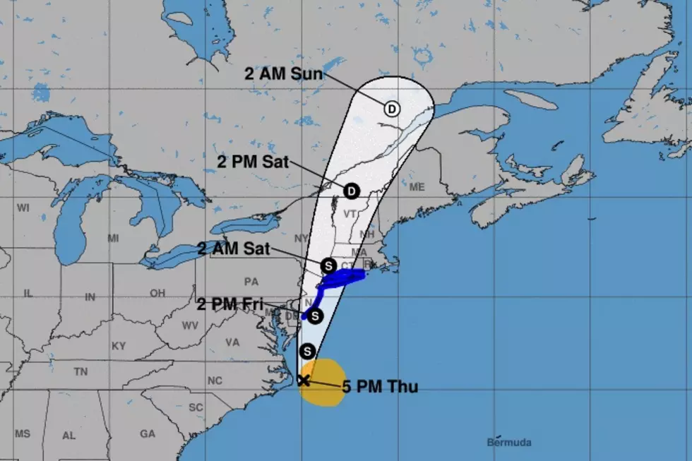
As of 5 p.m. Thursday, the National Hurricane Center officially upgraded an organized cluster of tropical rainfall off the North Carolina coast to Tropical Storm Fay.
Packing maximum sustained winds of 45 mph, the center of Fay is spinning about 240 miles south of New Jersey. The storm is crawling to the north at 7 mph.
Along with the upgrade in status comes a set of Tropical Storm Warnings posted from Cape May, NJ to Rhode Island. That includes the entire Jersey Shore: Cape May, Atlantic, Ocean, Monmouth, Middlesex, eastern Union, eastern Essex, and Hudson counties. A Tropical Storm Warning means tropical storm conditions — winds over 39 mph — are expected within 36 hours.
A Flash Flood Watch has also been issued for all 21 counties of New Jersey too, from Midnight to 4 p.m. Friday.
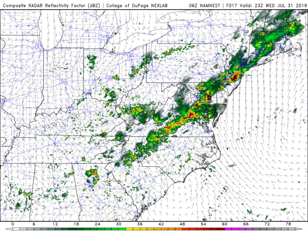
The upgrade in the storm's status and the warnings do not change our forecast at all. New Jersey's weather will go downhill late Thursday night, with first raindrops arriving in South Jersey around Midnight and heavy rain bands by sunrise Friday morning. The worst conditions will come during the daytime hours Friday. The center (eye) of the storm may make landfall along NJ's southern coast in the early afternoon. Conditions will gradually improve from south to north, from Friday afternoon to evening.
Our biggest concern from Fay will be bands of very heavy rain, leading to potential flash and river flooding. Top rainfall totals in New Jersey will probably exceed 3+ inches. Top wind gusts (along the coast) will probably exceed 40+ mph. Less than a foot of storm surge will cause minor coastal flooding at high tide. A high risk of rip currents is already posted for tomorrow.
For additional insight, please refer to my Thursday morning weather blog with a detailed breakdown of the timeline and potential storm impacts.
And stay with us before, during, and after the storm for the latest updates on Tropical Storm Fay.
Dan Zarrow is Chief Meteorologist for Townsquare Media New Jersey. Follow him on Facebook or Twitter for the latest forecast and realtime weather updates.
More From 94.5 PST


