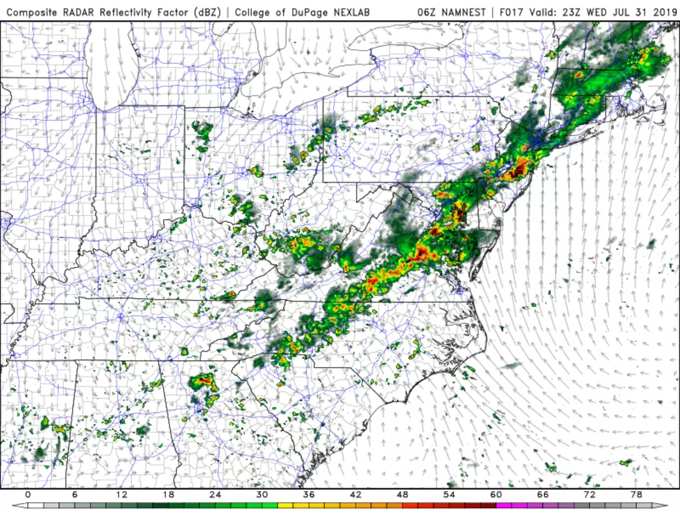
Thunderstorm grand finale: Flash flooding, severe weather likely again Thursday
Your Thursday turns mostly dry, aside from a few isolated showers.
Peeks of sunshine will push high temperatures into the lower to mid-80s. (Oh yes, you are definitely going to feel the humidity too.) As our atmosphere "cooks" and becomes more and more unstable, it will be primed for some loud thunderstorms.
The grand finale of this stormy week of weather will come later on. Starting around 3 or 4 p.m. Thursday afternoon, strong to severe thunderstorms will start popping up in New Jersey. Torrential rain and gusty winds are likely. Hail and an isolated tornado are possible.
It's definitely a day to stay "weather aware" — stay alert to changing weather conditions, and be prepared to take action and/or change plans in case warnings are issued.

These storms will impact the evening commute. And any outdoor graduation ceremonies scheduled for Thursday evening will be in jeopardy.
Because the ground is now thoroughly soaked, flash flooding will be an immediate concern with any duration of heavy rain. A Flash Flood Watch continues until 1 a.m. Friday for 16 counties in New Jersey: Atlantic, Burlington, Camden, Cape May, Cumberland, Gloucester, Hunterdon, Mercer, Middlesex, Monmouth, Morris, Ocean, Salem, Somerset, Sussex, and Warren.

Showers and thunderstorms will continue for a bit Thursday night. Yes, I've promised you drier air — but it's not going to arrive overnight. It's going to remain damp and foggy and steamy, with low temperatures only falling into the upper 60s.
Rain will finally exit the coast Friday morning, let's say by 10 a.m. at the latest. Skies will then become partly to mostly sunny, with a brisk northwesterly breeze occasionally kicking over 20 mph. Humidity levels will drop like a stone, so it will become much more comfortable by Friday afternoon. High temperatures should reach the upper 70s to around 80 degrees. Overall, your First Day of Summer is going to turn into a lovely day. (The Summer Solstice officially occurs at 11:54 a.m. EDT.)
The weekend still looks great too!
More From 94.5 PST