Passing system spits spotty showers and storms toward NJ Tuesday
Let's start by talking about the end of the forecast. I'm still loving the end of the week, Friday and the weekend. As humidity nosedives, we'll enjoy sunny skies, dry weather, and slightly-below-normal temperatures — it doesn't get much better than that in the summertime! Of course, we have to get through some humidity and thunderstorms first.
TUESDAY -
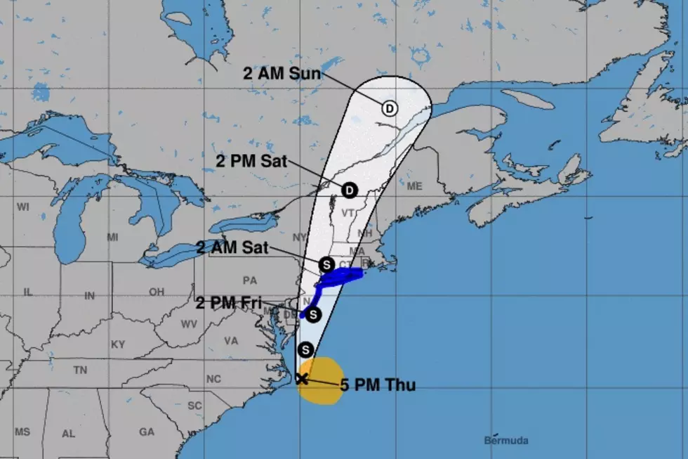
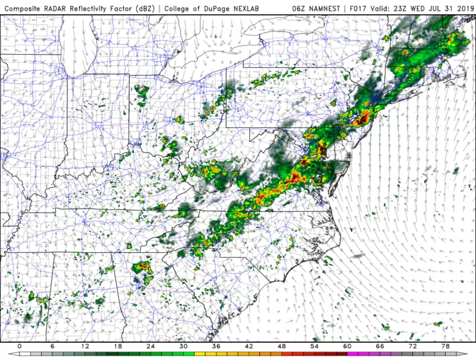
A storm system is just barely clipping the Jersey Shore on this Tuesday morning, spitting out some showers along coastal counties.
You'll probably catch breaks of midday sunshine, with building humidity and high temperatures pushing into the mid-80s. Then we'll have to keep an eye on the sky Tuesday afternoon. A round of spotty thunderstorms is expected, which could produce some localized downpours through the evening rush.
WEDNESDAY -
The day looks even more unsettled. The day will start with a mix of sun and clouds, with a stiff breeze and high humidity. As high temperatures reach the upper 80s, I think the heat index ("feels like" temperature) could approach the mid-90s — that's right on the edge of excessive/dangerous heat.
A few strong thunderstorms could pop up Wednesday afternoon. Gusty winds, hail, and heavy rain will be possible.
The weather looks great for the weekend as the humidity decreases by Friday.
Dan Zarrow is Chief Meteorologist for Townsquare Media New Jersey. Follow him on Facebook or Twitter for the latest forecast and realtime weather updates.
More From 94.5 PST