
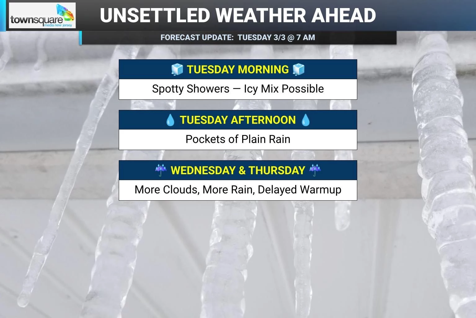
Spotty icy mix Tuesday morning kicks off period of unsettled weather for NJ
A Winter Weather Advisory has been issued for 11 counties in western and northern New Jersey Tuesday morning. Arriving spotty showers may produce some light snow, sleet, and freezing rain. While snow and ice accumulations will be limited, it may be enough for slippery travel conditions. This is the start of an unsettled weather pattern, early showers will transition to pockets of plain rain through Tuesday afternoon. It will be cloudy and cool, with highs on either side of 40 degrees. Rain continues Tuesday night, then Wednesday dries out a bit. Thursday will see showers too, with lots of clouds. Temperatures will try to warm up this week — a painfully slow process. Finally by this weekend, widespread 60s and 70s should break through statewide.
Tuesday NJ weather: AM icy mix, PM steadier rain
We have a storm system lifting northward into New Jersey Tuesday morning, driving in spotty showers. And temperatures are hovering right around the freezing mark across inland New Jersey. So the ingredients are there for some frozen, non-liquid precipitation — which we so fondly call "wintry mix".
Once again, the concern here is a matter of "timing" and not necessarily "totals". While we could see upwards of an inch of snowfall and a tenth of an inch of ice accumulation in NW NJ, the issue will be the roads through the morning commute. Any combination of snow, sleet, and/or freezing rain could lead to slushy, icy conditions for a few hours. And it does not take much of that to make things sloppy and slippery.
So the National Weather Service put out a Winter Weather Advisory for all or part of 11 New Jersey counties Tuesday morning, basically covering the western half of the state:
—Until 8 a.m... Salem.
—5 a.m. to 9 a.m... Northwestern Burlington, Camden, and Gloucester.
—5 a.m. to 11 a.m... Hunterdon, Mercer, and Somerset.
—7 a.m. to 3 p.m... Morris, Sussex, and Warren.
—10 a.m. to 10 p.m... Western Passaic.
Farther east, closer to the coast, temperatures will be warmer and therefore more conducive to overall wetter (and less icy) conditions.
As you can see by the expiration times of the advisories, by late morning, most of the state will have warmed up enough to force a transition to plain rain. Only areas along and north of Interstate 80 will have a continuing icing concern through the midday hours.
Pockets of rain look to become steadier through the afternoon hours, although I do not think we will see anything steady or long-lasting necessarily. It will stay cloudy and damp and dreary and foggy all day. And it will feel raw, with high temperatures ranging from the mid 30s (north) to mid 40s (south).
The chance of rain will continue into Tuesday night as well, lasting until after Midnight. Temperatures will hold steady overnight. So again, nothing heavy, nothing wintry, nothing crazy.
Wednesday NJ weather: Trending drier, still unsettled
Wednesday will be another unsettled weather day. But at least the daytime hours will trend drier. And there will be no threat of wintry weather going forward.
Expect lots of clouds. And a few late-day rain showers. High temperatures will reach around 50 degrees. There is a lot of give-and-take in that low-confidence number, as North Jersey could be closer to 40 and South Jersey could end up closer to 60 by Wednesday afternoon.)
Thursday NJ weather: Showers, a glimmer of warmth
Thursday will trend wetter again, although the day does not look like a washout. The best chance for rain showers, and maybe even a thunderstorm, looks to be early and late in the day.
In the middle, it will stay cloudy and blah. But at least we have a chance of tasting warm air in South Jersey. There will be a huge temperature gradient across the state Thursday afternoon, with highs ranging from the upper 30s to the north, to the mid 60s to the southwest.
Friday NJ weather: Cooling down, warming up
Even though Friday looks to dry out a bit, skies will remain gray. And a backdoor cold front will cause temperatures to crash and stay on the cool side for one more day.
I'll call it mostly cloudy, with highs in the 40s.
The weekend trends drier and significantly warmer. There are differing opinions among long-range models about just how warm Saturday will be. We should hit at least 50s, with a mix of clouds and sun. And then Sunday looks great, with partial sunshine and 60s (at least). Monday should be sunny and near 70.
While the springlike warmth will not last forever, it does represent a wholesale pattern shift from the constant onslaught of arctic cold and winter storms from the past month and a half. Even if things turn colder again next week, even if snow reenters the forecast, this is a good sign that more permanent warmups and longer-lasting springtime weather is coming very soon.
Glossary of NJ winter weather words and phrases
Gallery Credit: Dan Zarrow
Dan Zarrow is Chief Meteorologist for Townsquare Media New Jersey. Follow him on Facebook for the latest forecast and realtime weather updates.
Cough, cough: NJ's favorite lost voice and sore throat remedies
Gallery Credit: Dan Zarrow
More From 94.5 PST


