
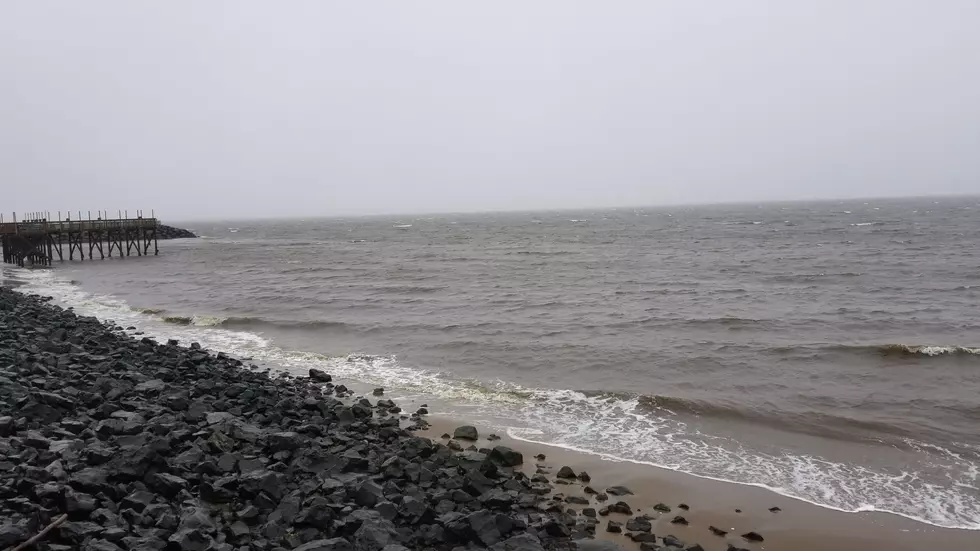
NJ’s coastal storm forecast: Minimal rain, some wind, significant coastal impacts
The Bottom Line
On this first full day of fall, we will benefit from some very dry air moving in at the surface and rain chances mainly going away for a few days. Spotty showers over South Jersey should exit by midday Wednesday, and then clouds will give way to breaks of sun through the afternoon. It will still be cool, with highs in the 60s. And the other big weather story will be wind — inland gusts will touch 30 mph, with gusts along the coast to 40 to 50 mph. The coastal flooding and rough surf will get worse along the Jersey Shore too, a problem through the rest of the week. See the Hazards section below for more information. While Thursday and Friday will be mainly dry, breezy, and just cool, we are still watching the development of a coastal storm — a nor’easter — for this weekend. I’m settling on a “middle of the road” forecast as it flies by: Far from a worst-case scenario, but not nothing. Not a lot of rain. Noticeable wind, but not necessarily destructive. The big issues will be felt along the Jersey Shore in terms of increased surge and surf. So we will be talking about coastal flooding and big waves a lot in the coming days, while further pinpointing rain timing and potential wind gusts too.

Weather Hazards
Gusty winds, rough surf, and persistent coastal flooding will be big concerns through the rest of the week into the weekend.
A Wind Advisory has been issued for coastal areas of New Jersey for Wednesday, as gusts may reach 40 or 50 mph. That is enough to make driving difficult, bring down small branches, relocate your garbage can, and cause sporadic power outages.
In addition, the coastal flooding picture becomes more serious. A Coastal Flood Warning is now posted from Ocean County to Cape May County, with a less severe Coastal Flood Advisory for other Shore points. Tidal guidance suggests Wednesday evening’s high tide cycle could push past moderate flood stage, which is where we start to worry about impassable roads and potential property damage. By Friday into the weekend, tide levels may approach major flood stage.
Finally, ocean wave heights will grow to about 6 to 10 feet Wednesday — easily the biggest of the season. Not only does this present a high risk of rip currents and incredibly dangerous swimming conditions, significant beach erosion is possible. These coastal problems will persist through the rest of the week.
Climatological Context
September 23 is the 266th day of 2026.
Normal high temperatures range from 75 to 76 degrees, while normal low temperatures range from 55 to 58 degrees.
September is, on average, New Jersey’s fourth warmest and sixth driest month of the year.
Wednesday
The wind is the big weather story Wednesday.
Temperatures are mainly in the 50s to start the first full day of fall. It is cool and fairly calm across inland New Jersey early on, although conditions are already much rougher at the Jersey Shore.
South Jersey is starting damp, with showers and sprinkles lingering through the morning. Nothing heavy — perhaps around a tenth of an inch of additional rainfall. Final raindrops should clear southern and coastal New Jersey by about 10 or 11 a.m.
Then New Jersey enters a mainly dry stretch for a few days.
Clouds should give way to hints of sun through Wednesday afternoon. High temperatures will still be on the cool side, only reaching the mid 60s. Similar to Tuesday, and still running 10+ degrees below normal for this time of year.
The bigger issue will be the wind, for several reasons. Gusts throughout Wednesday will reach around 30 mph inland and 40 to 50 mph near the coast. That is strong enough to cause some driving difficulties, toss around loose outdoor objects, bring down small tree branches, and potentially cause scattered power outages.
At the Jersey Shore, surf conditions are downright angry. Waves of 6 to 10 feet combined with strong onshore winds will make the ocean extremely hazardous. Stay out of the water.
During Wednesday evening's high tide cycle, water levels are expected to rise about 2 feet, equating to moderate category flooding. This is expected to be the case for the next several days in a row.
Wednesday night will be partly cloudy and still breezy. Look for lows in the lower 50s.
Thursday
The brisk wind continues Thursday, as we stay cool and mainly dry.
Expect clouds and sun throughout the day, with high temperatures again in the mid 60s.
An isolated shower can't be ruled out, especially along the coast. But truly, rain chances are minimal overall.
It will be breezy to windy again, especially near the Shore. Coastal flooding and rough surf will be just as big a concern.
Friday
Friday has the potential to be a decent late September day.
Again, it looks pretty dry. We should see a mix of sun and clouds. (Note I put the "sun" before the "clouds" here.) It will be breezy, at least. And hopefully high temperatures will push closer to about 70 degrees. That is still a bit below normal for late September, but at least temperatures will begin moderating.
Rain chances are not zero Friday, but it should not be a major factor. Wind will be more noticeable, especially as the developing coastal storm starts to organize offshore.
Saturday & Beyond
The coastal storm / nor'easter is obviously the big question mark heading into the weekend. There have been several scenarios on the table so far, ranging from a direct hit, to picking up tropical characteristics, to a storm that stalls and lingers nearby for days.
Confidence is growing that none of those extreme solutions will happen. Instead, the most likely
outcome appears to be a simpler coastal storm fly-by.
So at this point, I am leaning toward a “middle of the road” outcome for New Jersey. Far from those doom-and-gloom worst-case scenarios that have been floating around. But definitely not "nothing".
Here's the very basic, very broad rundown of overall potential nor'easter impacts as it stands now:
—Rainfall... Ranging from nothing to up to an inch
—Wind Gusts... Up to about 40-50 mph along the coast (the strongest 70 mph gusts will stay well off-shore)
—Storm Surge... 2 to 3 feet, enough to cause several rounds of moderate to localized major category flooding from Wednesday through Sunday
—Rough Surf... Ocean waves 6 to 10 feet, causing significant beach erosion
—Snow... Absolutely positively none
Saturday is when that coastal storm starts making its presence more obvious.
Clouds will increase, the chance of rain will increase, and winds may become quite gusty. Still, forecast models put high temperatures in the lower 70s.
Rain is a possibility, especially late-day. However, this does not currently look like a multi-inch statewide deluge. The best chance for wet weather would be to the north and east.
Wind will be noticeable Saturday into Sunday, but widespread destructive gusts are not likely either..
The biggest problems will likely remain coastal: strong onshore winds, elevated water levels, major waves, beach erosion, and potentially significant tidal flooding.
Sunday looks cloudier, cooler, somewhat rainy, and breezy, with highs back in the 60s. However, keep in mind the exact timing of the storm’s closest pass — and therefore the timeline of the rain, wind, and worst coastal flooding — still has some wiggle room.
Don't buy into apocalyptic nor’easter hype. But this remains a "worth watching" meaningful coastal storm. Especially if you live, work, travel, or own property near tidal waterways.
Once the storm passes, sunshine should return early next week. Until then, hold on tight for a bumpy first weekend of fall!
16 ways the weather can impact your Jersey Shore beach day
Gallery Credit: Dan Zarrow
Dan Zarrow is Chief Meteorologist for Townsquare Media New Jersey. Follow him on Facebook for the latest forecast and realtime weather updates.
The complete list of storm names for the 2026 Atlantic Hurricane Season
Gallery Credit: Dan Zarrow


