
More ‘weather whiplash’ for NJ this weekend: Warm, wet and windy, cool
The Bottom Line
Remember Monday's weather? It was ridiculously warm, then increasingly windy. Then it rained. Then it got even windier. Then it got cool again.
That's exactly what the forecast for Saturday looks like. Turbulent weather may impact your outdoor plans Saturday evening, with the chance for rare December thunderstorms.
But the long-range forecast shows a quieter, more pleasant pattern settling in. No wintry weather threat is expected for the next 7 to 10 days. Not even a flake.
Friday
Friday will be almost 10 degrees warmer than Thursday. Definitely a good trend.
As of this writing (6 a.m.), temperatures are hanging right around the freezing mark. We'll see high temps in the upper 40s to around 50 degrees.
We're now at the point of the year, through early March or so, when 50+ degrees is considered mild. Whether or not you hit 50+ Friday will depend on two factors: 1.) how far south you are, and 2.) how much sunshine you see.
Look for a mix of clouds and sun throughout the day, with light winds and dry weather. All in all, a reasonably pleasant December day.
Friday evening, a warm front will lift from south to north through New Jersey. That will drive in a batch of spotty rain showers — just some damp weather. Patchy fog may develop Friday night too.
Temperatures will dip a few degrees, into the mid 40s, Friday evening before slowly rising early Saturday morning. Another effect of that warm front.
Saturday
Mild, murky, loud.
High temperatures on Saturday will surge into the 60s across the state. (I'm thinking lower 60s north, upper 60s south.) While the daytime hours look dry and tranquil, it will be cloudy and increasingly breezy.
There are two caveats to add to Saturday's daytime forecast. First, there is one model — the short-range HRRR — that puts an odd piece of energy and healthy rain over New Jersey in the morning hours. I've opted to ignore that possibility, as it stands as the lone model and run with that suggestion. Second, winds way up in the atmosphere are going to be screaming all day tomorrow. They shouldn't have a mechanism to mix down to the surface until the rain arrives. But I'll still be watching in case the forecast needs to trend in a "breezier" direction.
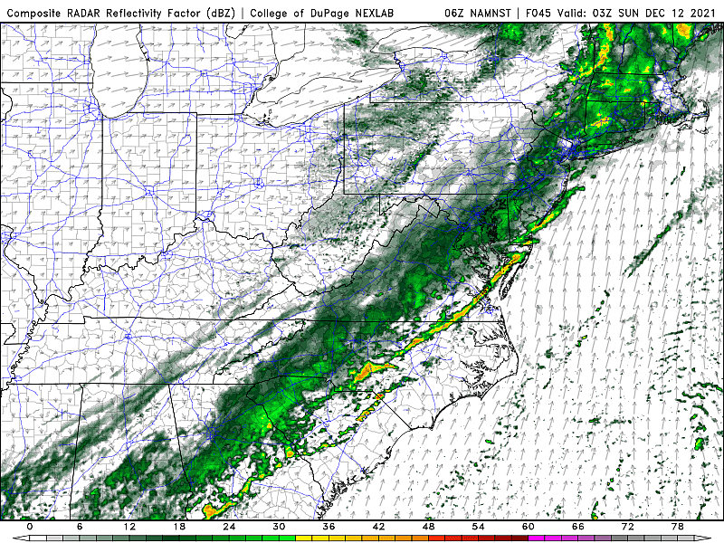
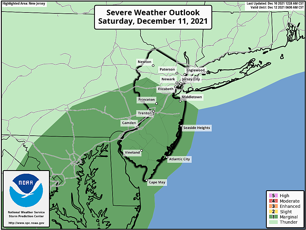
Starting Saturday evening, a cold front will make its approach from the west. Between about 6 p.m. and Midnight, we'll see a band of rain pass through over the state. Total rainfall about a quarter-inch. Given the relative warmth, humidity, and wind shear, there is a decent chance for some strong thunderstorm cells. The Storm Prediction Center even puts most of NJ in a "marginal risk" of severe wind and an isolated tornado. In December! A potentially noisy end to the day.
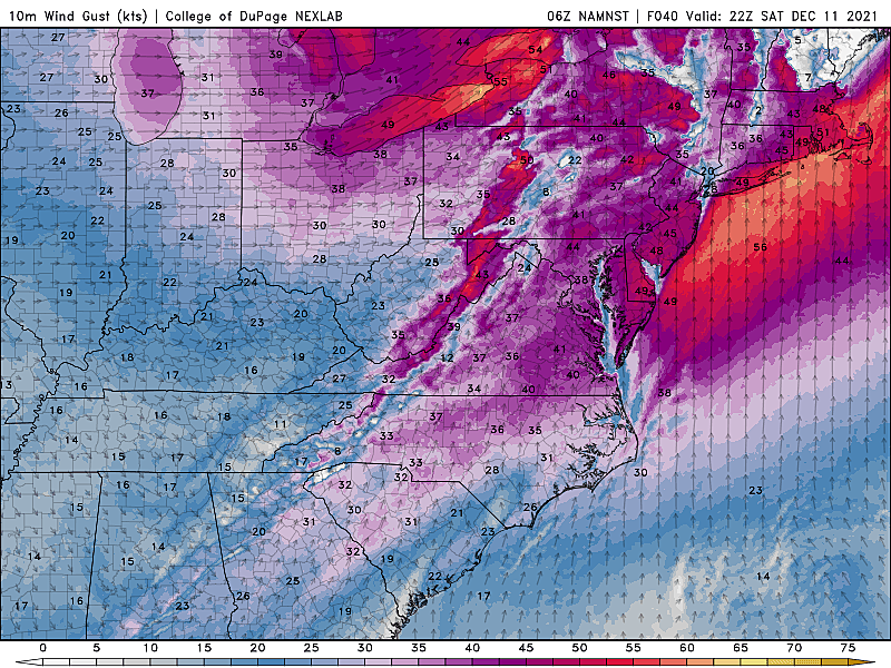
After the rain and thunderstorms, winds may clock 40+ mph as colder air "whooshes" in Saturday night.
Sunday
Cooler. But not that cold. Temperature will really just get knocked back to near normal.
Sunshine will emerge by mid-morning Sunday, with a continuing stiff breeze out of the northwest. High temperatures are forecast to reach the mid 40s or so. As long as it's not too windy, it should be a nice day. The start of a dry, pleasant stretch of weather.
Monday & Beyond
A huge dome of high pressure will settle over the mid-Atlantic next week, keeping our weather pleasant and silent.
Sunshine and 50s for Monday and Tuesday? Very nice. Clouds and a shower are possible for Wednesday. But then we could see 60s again on Wednesday.
Long-range guidance shows a late-week cold front, that may or may not have some precipitation and/or wind attached to it. Until then, smooth sailing as we count down the final week and a half of autumn.
Have a great weekend! Stay smart and be safe out there on Saturday.
Dan Zarrow is Chief Meteorologist for Townsquare Media New Jersey. Follow him on Facebook or Twitter for the latest forecast and realtime weather updates.
25 Christmas songs performed by NJ artists
Gallery Credit: Joe Votruba
Favorite holiday movies from your childhood that will never get old
Gallery Credit: Kristen Accardi
More From 94.5 PST


