
NJ blizzard rages on: How much more snow, and when will it end?
UPDATE as of 9 a.m. Saturday...
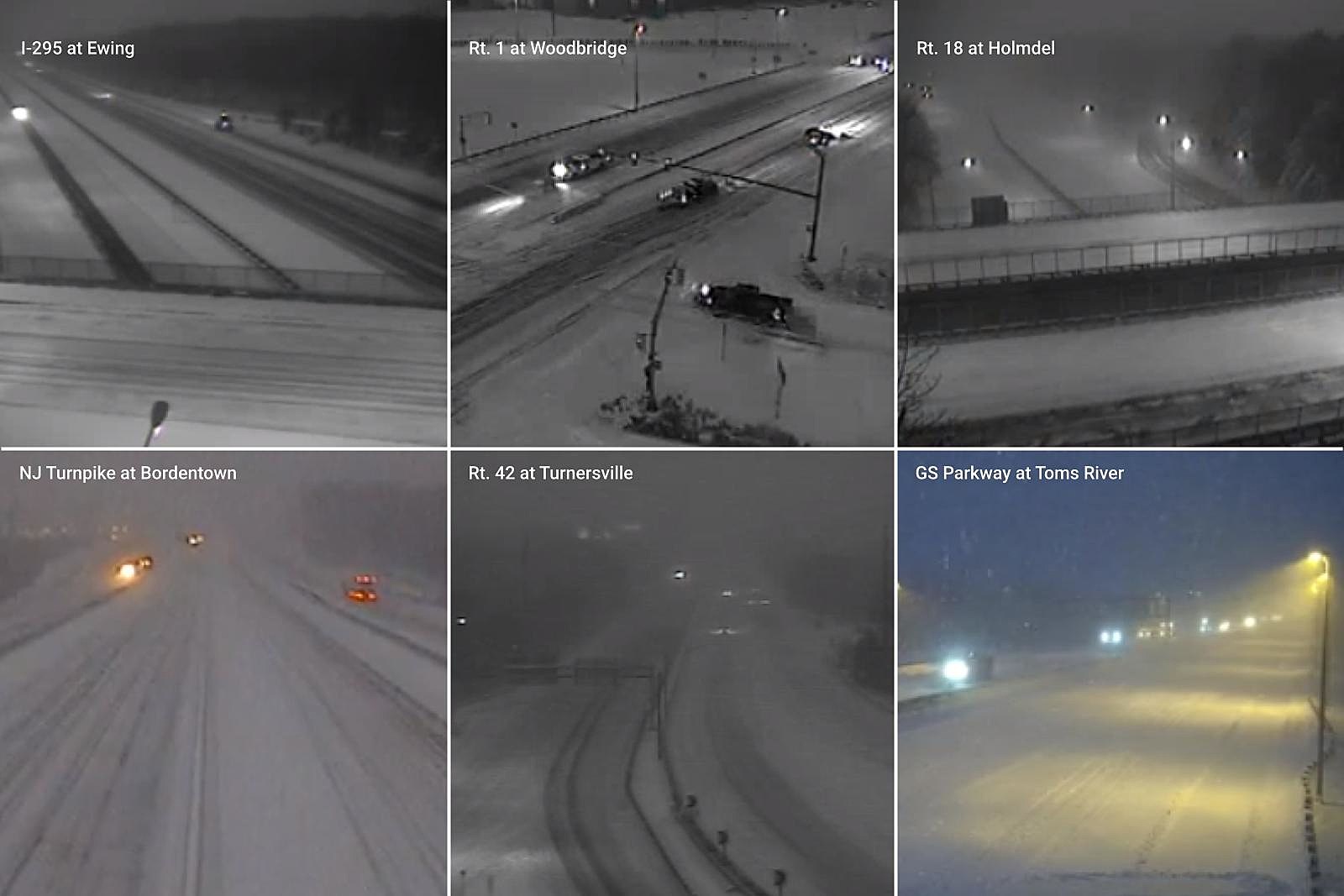
We are starting to turn the corner now. Here are a few updates as we continue trudging through this snowy, wintry morning.
--The heaviest snow band has now shifted about 20 miles off the coast. So conditions have improved along the Jersey Shore. Steady light to moderate snow continues to fall statewide.
--Additional accumulation? About a half-inch to an inch for most of the state. Possibly up to two inches in the "sweet spot" in coastal counties.
--We just had a few gusts over 40 mph near the coast too, keeping conditions blizzard-ish. And keeping wind chills in the single digits. Brrr!
--The coastal flooding threat is over. All gauges have fallen below flood stage, water has receded, and those warnings/advisories have been dropped.
Everything else from my early morning forecast post below is still valid. Be safe and stay warm out there!
ORIGINAL POST from 7:20 a.m...
How's the weather?
Snowy. And windy. It is a mess across much of New Jersey early on this Saturday morning. And we still have several more hours of stormy, wintry weather to come.
The forecast so far has played out remarkably close to forecast. Truly heavy snow has been limited to areas southeast of the NJ Turnpike, specifically along our coastal counties. National Weather Service estimates early morning snowfall rates exceeded 2" per hour at times. Combined with wind gusts over 40 mph, we have high drifts and very low visibility (near whiteout, in fact).
Farther north and west, conditions have been drier but still wintry. Light to moderate snow has been falling steadily all morning.
Also, as of this writing (6:30 a.m.), we are past high tide along the Atlantic Ocean, coming up on the crest of back bays and tributaries. So far, tidal guidance was spot on with its estimate of surpassing "minor" flood stage. There could be areas of water inundation, on the order of a foot or two, in low-lying or particularly vulnerable areas.
And, of course, it's also very cold outside. Temperatures are in the 20s. Wind chills are in the single digits and teens.
How much snow so far?
Early morning snowfall observations are hard to come by, but we've seen several towns in Ocean, Atlantic, and Cape May counties with double-digit snowfall (over 10 inches). That includes Port Republic, Cape May, Forked River, and Toms River. Southeastern Monmouth County is getting very close to that mark too.
Farther north and west, we're going past 8 inches in Burlington counties, 6 inches in Camden and Gloucester, and probably exceeding about 5 inches in parts of Mercer and Middlesex. Drier air has been the winner in northwestern New Jersey, but Wantage in Sussex County has still seen 2.5 inches of accumulation so far.
How much more snow is expected?
Studying the latest radar trends and model guidance, as of 6 a.m., I think we're potentially in for another inch or two of accumulation along the western edge of New Jersey (Delaware River). Closer to the coast, you'll probably add another 4 to 6 inches by the time things wrap up. (Again, that is on top of whatever has already fallen as of 6 a.m. Saturday.)
When will it end?
The brunt of the storm will continue until about 10 a.m. Saturday morning. That will include heavy snow along the coast and moderate snowfall farther inland. The gustiest winds will occur through the morning too, up to 40 mph inland and 50 mph coast.
Beyond 10 a.m., we should see the snowfall and wind calm down. And that will allow road crews to finally get ahead of the storm and get major roads cleared.
But the snow will continue to fall until sometime Saturday afternoon. I expect final flakes sometime between 1 p.m. (west) and 5 p.m. (east).
What's ahead?
Quiet but cold weather settles in, as we prepare to wrap up January.
Saturday night, temperatures will dip into the single digits across almost all of New Jersey. Factor in the bitter breeze (15-ish mph), and you get wind chills in the "danger zone" as low as -10 degrees.
Sunday will be sunny and dry, but we're stuck below freezing all day. Highs will only reach the upper 20s, at best.
Partly sunny and 30s on Monday and Tuesday. Mostly cloudy and 30s on Wednesday.
Our next storm system is forecast to roll into New Jersey in the Thursday-Friday time frame. Right now, it looks like that will come with some warmer air. So I'd call it a rain-to-mix event. But let's see how the models shake-out over the next few days.
Be smart. Be safe. Be warm.
Dan Zarrow is Chief Meteorologist for Townsquare Media New Jersey. Follow him on Facebook or Twitter for the latest forecast and realtime weather updates.
Your photos: First blizzard of 2022 in New Jersey
Gallery Credit: New Jersey 101.5 users
LOOK: Here are copycat recipes from 20 of the most popular fast food restaurants in America
What Are the Signature Drinks From Every State?
More From 94.5 PST


