
UPDATE as of 1 p.m. Wednesday...
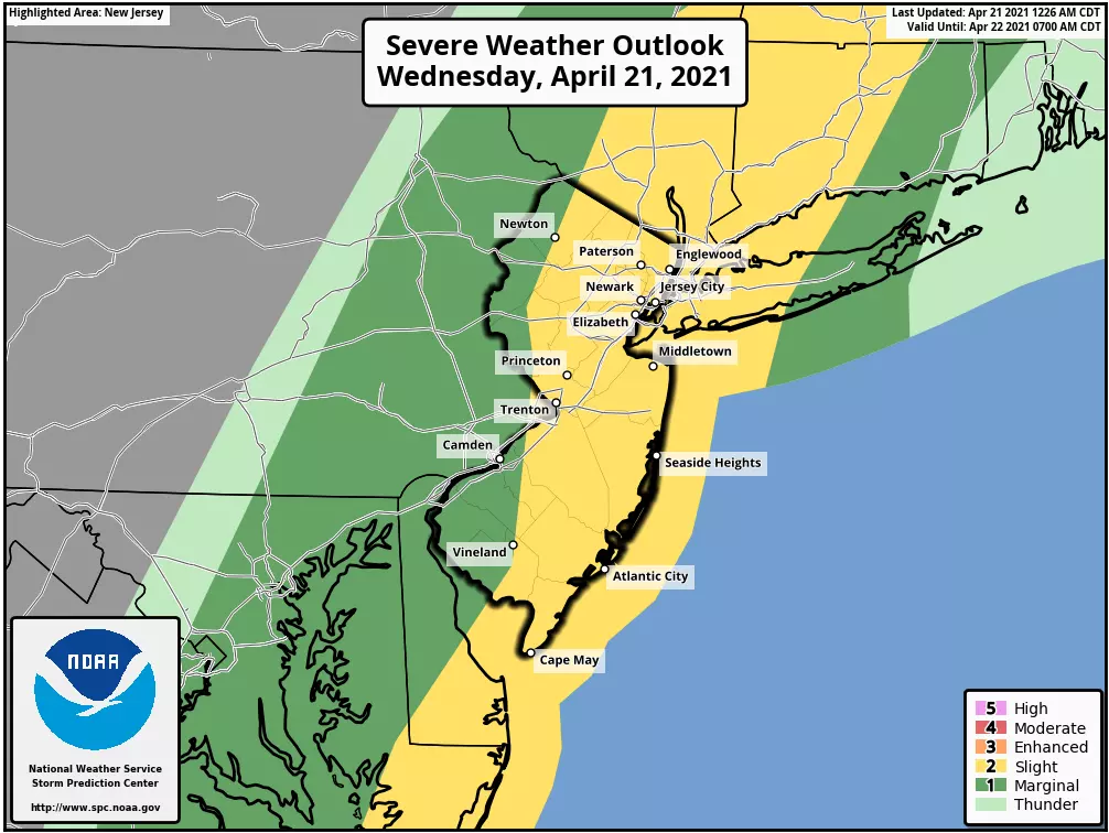
The National Weather Service has issued a Severe Thunderstorm Watch for all 21 counties in New Jersey, in effect until 6 p.m. Wednesday. A watch serves as a formal heads-up to the possibility of dangerous weather, including wind, hail and/or a tornado.
You should continue to monitor changing weather conditions carefully through the afternoon, and be prepared to take shelter if a Warning is issued.
The Bottom Line
A strong cold front will spark some turbulent, active weather across all of New Jersey on Wednesday. A line of thunderstorms will roll in (and exit) quickly in the afternoon. And then a brisk wind will cause temperatures to take a big tumble Wednesday night.
We’re looking ahead to roller coaster temperatures. Our next rain chance will arrive this weekend.
Wednesday
Runaway warmth and bright sunshine made Tuesday a spectacular spring day. Wednesday will start off fine. But Wednesday afternoon and Wednesday night, not so much.
We’re waking up to temperatures primarily in the 50s. As clouds increase Wednesday morning, thermometers will push toward a high around the mid 60s. So far so good.
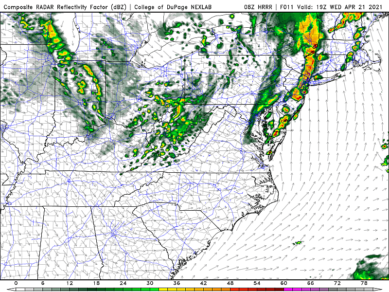
Then Wednesday afternoon (Noon to 5 p.m.), a broken line of strong to severe thunderstorms will sweep west to east across New Jersey.
Heavy rain, gusty winds, and frequent lightning are the primary concerns. Small hail and an isolated tornado are possible.
Please keep an eye on the sky, and stay alert to changing weather conditions. These storms will roll in quickly. And they will be brief, but potent.
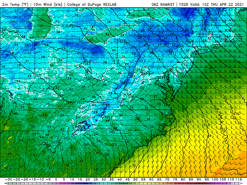
Following the stormy weather, a brisk northwesterly wind will kick up, possibly gusting to 40 mph. As cooler air arrives, temperatures will tumble. (So far and so fast, I almost want to call this an arctic blast!)
Overnight temperatures will bottom out in the lower to mid 30s. Definitely frosty, with a freeze possible away from the coast.
In addition, that brisk wind will probably push the wind chill (“feels like” temperature) into the 20s by Thursday morning. Quite unusual and unseasonable for late April - about 10 degrees below normal, and close to record lows.
Thursday
After a cold start, we won’t do much better Thursday afternoon. Especially since a chilly breeze will continue to blow out of the west-northwest (gusts to 30 mph). Thermometers will struggle to even reach 50 degrees Thursday, despite a return to mostly sunny skies.
Friday
Much better.
Sunny and more seasonable, with highs popping back into the lower 60s. It may still be breezy at times, but the day looks completely dry.
The Weekend
Mixed news.
Most of Saturday looks pretty good. We’ll progress from sun to clouds, with above-normal highs in the mid 60s or so.
Then, an area of low pressure is forecast to pass directly over New Jersey from Saturday night (5 p.m.) through early Sunday (Noon). That means we face a period of steady, if not heavy, rain.
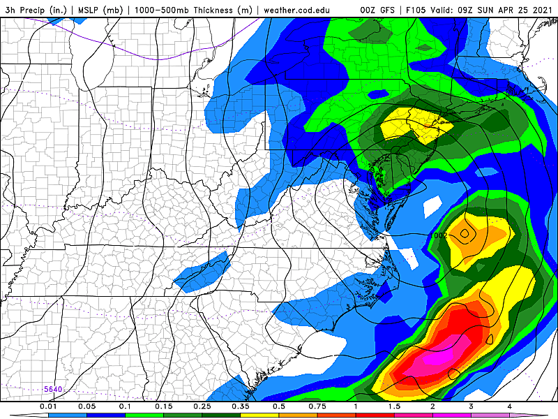
Model guidance has remained pretty steady about the track and timing of this storm, so we're becoming more confident that approximately half of the weekend will be soggy. Rainfall totals could exceed an inch across most of the state, with the heaviest stuff coming during the overnight hours.
Sunday will be the cloudier and cooler day of the weekend. As rain wraps up midday, we’ll see highs pop to around 60 degrees.
The Extended Forecast
This weekend’s storm might actually be the last round of rain in the month of April. Next week looks very quiet. Sunshine and 60s/70s should lend toward a beautiful stretch of weather.
Please be smart and stay safe during this afternoon’s thunderstorms. See you tomorrow!
Dan Zarrow is Chief Meteorologist for Townsquare Media New Jersey. Follow him on Facebook or Twitter for the latest forecast and realtime weather updates.
New Jersey is one of the biggest exporters of this
Gallery Credit: Dennis Malloy
Small towns in New Jersey you didn't know existed
Gallery Credit: Dennis Malloy
More From 94.5 PST


