Winter storm warnings, advisories for southern half of NJ: Snow Q&A
UPDATE... This article is outdated...
For the latest winter storm forecast information, please refer to my newest weather blog post.
What's new?
—Since my comprehensive Sunday morning weather blog post, we have two more model runs and a lot more analysis under our meteorological belts. The bottom line of this winter storm forecast remains the same: Significant snow for South Jersey, hardly anything for North Jersey.
—Our initial big cooldown is on schedule, as temperatures have already started to cool rapidly in the northwest corner of the state. Thermometers will tumble about 25 degrees within a few hours Sunday night, accompanied by a brisk northwest wind.
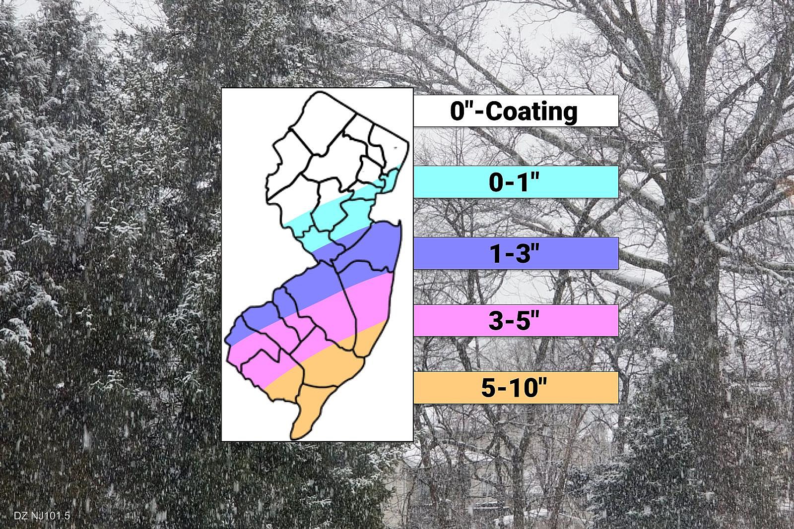
—For my latest snowfall forecast map, I decided to "compress" the totals a bit. Dry North Jersey goes down. Snowy South Jersey goes up. The contours (the lines and colors) pretty much stayed the same on this map — I just tweaked the numbers a bit.
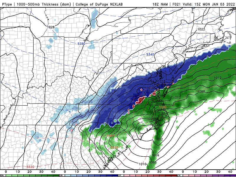
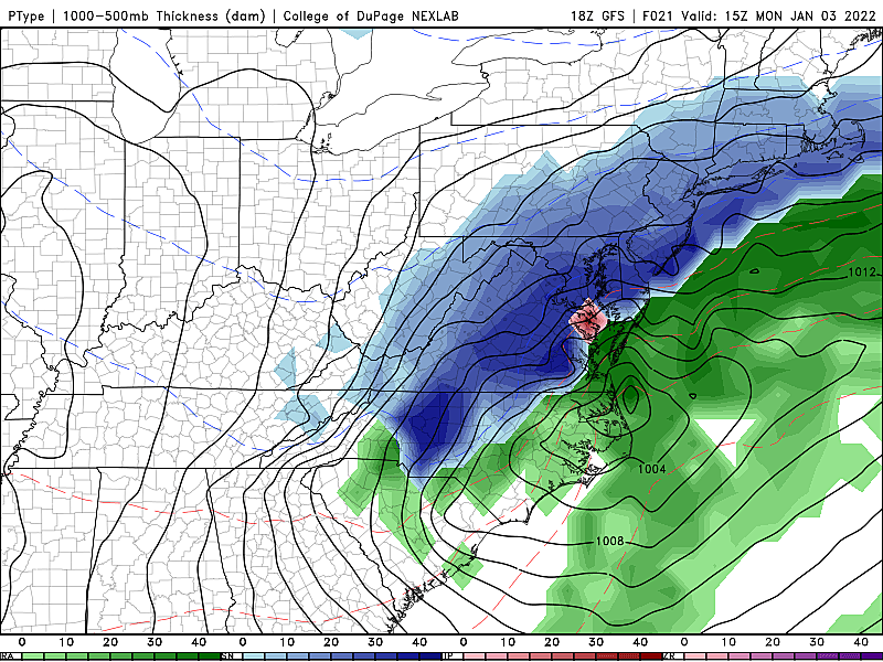
—Going by raw model output, maximum snowfall for inland South Jersey would be on the order of 20 inches. Yikes! But don't pay attention to that drama and hype — there are so many limiting factors at play. Dry air, warm ground, rain/mix at onset. I think we'll end up far from those huge totals, but still firmly within "plowable snow" range for all or part of 8 counties in the southern half of NJ.
—One of the biggest challenges in this forecast is nailing down the duration of initial mixing — we should be "all snow" by 9 a.m. at the latest. The other big issue is figuring out the most likely location of heavier, mesoscale snow bands that will develop Monday morning.
—The rest of this article takes a "Question and Answer" format, to run down when and how this winter storm may affect you.
Why does this storm seem like such a "surprise"?
If you scroll back through my blogroll, you'll see we have been peripherally watching this chance of wintry weather since last Monday. But I largely wrote it off, figuring post-frontal dry air would win out and the storm will stay off the coast.
Then models took a dramatic shift late on Saturday, leading forecasters (including myself) to take the snow threat much more seriously.
In addition, coming off Winter Break, many New Jerseyans are headed "back to school" and "back to work" on Monday, for the first time in 2022. I'm sure many of them haven't paid close attention to the weather forecast while on vacation. Of course, it is January now — on average, our second snowiest month of the year. (Behind February.)
What is the overall timeline for the snow?
First snowflakes and raindrops will enter southern New Jersey just after Midnight Sunday night, spreading northward through early Monday morning. We'll enter the "brunt" of the storm — the period of heaviest and most widespread precipitation bands —starting about 5 a.m. That's when the snow will begin to accumulate, first on cold and grassy surfaces, and then (eventually) on paved roadways, sidewalks, etc.
Note: Yes, it will likely take several hours for falling snow to "stick" and start to accumulate.
Snow should start to taper by mid Monday afternoon, with much improved conditions by the evening commute. Final flakes should fall in New Jersey by 6 p.m. Monday, at the latest.
When will be the worst time to travel?
Generally, Monday morning. Let's say 8 a.m. to Noon. There's reason to hope the heaviest snow bands will hold off until mid to late morning, after the AM rush hours. Road crews wil hopefully be able to get ahead of the snowy, icy conditions through the afternoon.
Will it be all snow?
Winter storms are always complicated. A difference of a single degree on the thermometer can lead to a completely different scenario.
In this case, I do think temperatures at the surface in southeastern New Jersey will be just above freezing at the onset of precipitation. That means through the morning commute, much of South Jersey will probably experience rain and/or icy mix for several hours. No accumulation yet.
Eventually, temperatures will fall below-freezing statewide, for the duration. As I mentioned above, after 9 a.m. (at the latest), everything that falls from the sky will be snow through the rest of the storm.
How much snow will fall? How much snow will stick?
As I referenced above, it may take a while for snow to start to whiten up the ground. So the answers to those two questions are very different. And it's really the second once that matters: Accumulations.
I've bumped up my snow totals in SE NJ to 5 to 10 inches. That qualifies as a major winter storm, leading to widespread travel disruptions. Snow plows are revving their engines, and shovels are ready for the first use of the season.
If I had to guess, the overall snow bullseye will probably be inland Atlantic County.
Farther north, up to a line between about Salem and Brick, moderate snowfall of 3 to 6 inches is forecast. Certainly enough to slicken up roads, snarl traffic, and force schools/business to close.
It's important to note that the bottom and top of these snowfall ranges represent the lowest and highest case scenario, respectively. This is very much a "boom or bust" situation, and I do not expect snow totals in the "middle" of those ranges here.
How far north will (accumulating) snow reach?
South of a Trenton-Perth Amboy line, it does look like a snowy morning. (Although that's not a slam dunk forecast.) I've cautiously painted 1 to 3 inches for the I-195 and I-295 corridors.
And the farther north you go, the harder it will be to see any snow accumulation. That's because North Jersey will be pretty far from the center of the storm system. And it's also because dry air will prevent precipitation from fully reaching the ground.
On my latest snow map above, I have noted the possibility of a coating or an inch of snow along and south of the NJ Turnpike corridor. Note: Zero is also a distinct possibility here.
Far NW NJ, this isn't your storm. Flurries are possible, but little to no accumulation.
Any other issues to know about?
Northerly wind gusts will probably hover near 30 mph for most of the day.

That will contribute to blowing snow and further reductions in visibility. That could also lead to power outages due to downed trees and power lines.
Finally, the wind chill (the "feels like" temperature) will be stuck in the teens all day long. Bundle up!
What warnings/advisories have been issued?
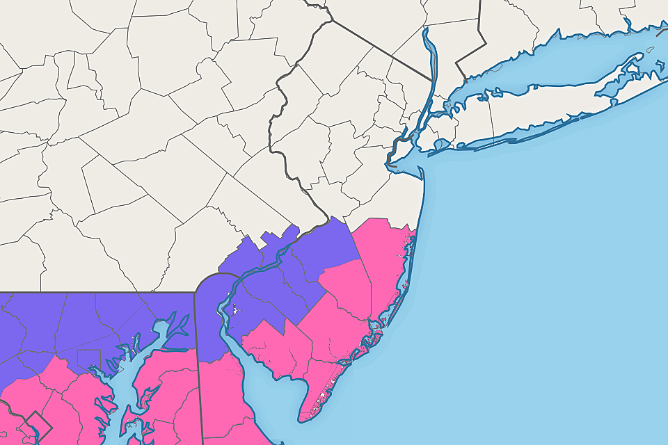
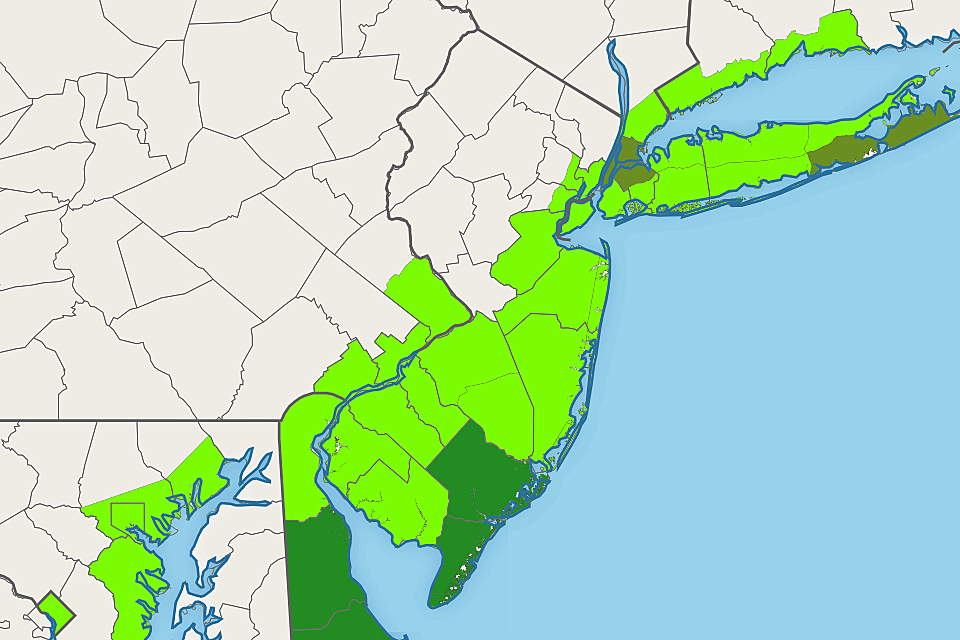
A Winter Storm Warning has been posted for Ocean, southeastern Burlington, Atlantic, Cape May, and Cumberland counties from 4 a.m. to 4 p.m. Monday. That is the most likely location of heavy snow. And the most likely time frame for treacherous travel.
A less-urgent, less-severe Winter Weather Advisory has been issued for Salem, Gloucester, Camden, and northwestern Burlington counties for the same time frame, 4 a.m. to 4 p.m. Monday. Less snow on the ground, but still potential travel impacts.
A Coastal Flood Warning is also posted for Atlantic and Cape May counties. The Monday morning-midday high tide cycle is forecast to cause widespread moderate flooding of tidal waterways. That may necessitate road closures and could even cause property damage.
Farther up the Jersey Shore, a Coastal Flood Advisory called for minor category flooding at high tide Monday.
What should I do to prepare for the storm?
By now, you've already taken the most important step: You know there's going to be a winter storm in the neighborhood. Make sure all your friends and family know of the potentially bad weather on the way.
Carefully consider your plans on Monday and whether it will be safe to travel during your normal routine. The answer to that question will depend largely on what, when, and where those plans are, your vehicle, your driving ability, etc.
School superintendents, business owners, and organization leaders within the warning zone (and the advisory too) should consider whether to close school on Monday (or switch to a "remote learning" day). As I've said previously, there seems to be little point to a delayed opening or early dismissal for this one.
If you haven't already, it's probably not too late to stock up on salt, batteries, and/or french toast supplies. You may want to strategically park your vehicles to mitigate snow and/or coastal flooding issues.
Finally, be ready to change your plans as the weather goes downhill and the forecast evolves throughout the day Monday.
What's next?
Our on-air and online coverage will ramp up starting early Monday morning. (I take over the weather center at 3 a.m., for the duration of the storm.)
Expect one more comprehensive online write-up about the snow potential around 7 a.m. Monday. And then regular play-by-play both on the radio and on social media, until the final flakes fly.
Dan Zarrow is Chief Meteorologist for Townsquare Media New Jersey. Follow him on Facebook or Twitter for the latest forecast and realtime weather updates.
Counting down New Jersey's top 15 weather stories of 2021
Gallery Credit: Dan Zarrow
First flakes: When does snow season start in NJ?
Gallery Credit: Dan Zarrow
More From 94.5 PST


