

Eyes on the sky, NJ: Stormy Tuesday with flooding rain and severe weather likely
The Bottom Line
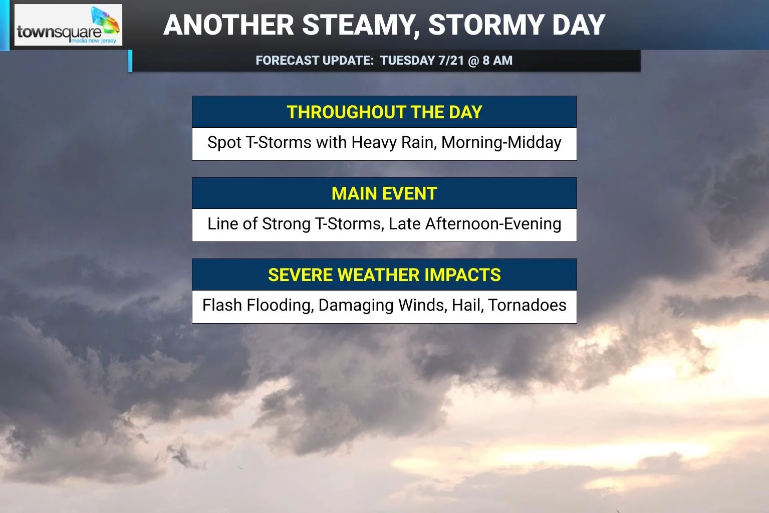
Heads up: All the ingredients are coming together for a nasty, stormy weather day Tuesday. As humidity flows into New Jersey's atmosphere Tuesday morning, you will immediately feel the difference in how steamy and thick the air is. And that moisture will help fuel a few rounds of thunderstorms over the next 24 to 36 hours. The first push of spotty showers and thunderstorms will run from morning through midday. The second, bigger line of strong thunderstorms will arrive from late afternoon through Tuesday evening. Pockets of heavy rain, potentially exceeding 1 to 2 inches per hour, could lead to flooding of low-lying areas. And all modes of severe weather — wind, hail, and tornado — are on the table as well. By Wednesday, our weather will settle down quite a bit, with just lingering showers and clouds and decreasing humidity in the forecast. Thursday will be a refreshing weather day, thanks to the return of sunshine and dry air. That should set us up for a pleasant, seasonable run of days through the upcoming last weekend of July.

Weather Hazards
We have some major alarm bells to ring for Tuesday, as it looks like a serious "weather aware" day for New Jersey.
A Flood Watch is in effect for most of the state from 6 a.m. Tuesday to 2 a.m. Wednesday. Technically, this watch covers all or part of 14 NJ counties — but realistically, I would say heavy rain is a possibility statewide, as multiple rounds of thunderstorms develop throughout the day. Rainfall rates may exceed 1 to 2 inches per hour, and some forecast models suggest isolated pockets of more than 4 inches of total rainfall. That is a lot of water — more than enough to cause flash flooding on roads, along waterways, and in other low-lying or poor-drainage areas.
Severe thunderstorms are also a concern, especially late-day Tuesday. Damaging wind gusts over 60 mph top the list, but the strongest thunderstorm cells may also be capable of producing hail and an isolated tornado.
Not every town will see the worst flavor of weather. And it is important to note that it will not rain constantly all day. But conditions could turn hazardous in a hurry.
It will be very important to keep an eye and an ear on the sky throughout Tuesday. Closely monitor weather conditions and be ready to seek shelter if thunderstorms threaten your area.
Climatological Context
July 21 is the 202nd day of 2026.
Normal high temperatures range from 86 to 87 degrees, while normal low temperatures range from 67 to 70 degrees.
July is, on average, New Jersey's hottest and wettest month of the year.
Tuesday
You will notice a difference in the air the instant you walk out the door Tuesday morning. Temperatures are in the 60s and 70s, considerably warmer than Monday morning. Those higher morning temperatures are a symptom of higher humidity in our atmosphere. It is going to feel tropical, thick, and steamy all day.
That very moist air actually connects to Tropical Storm Bertha, which has formed in the Gulf. While the storm itself is steering toward a Louisiana landfall late Wednesday, there is a clear moisture connection between Bertha and New Jersey's atmosphere. Tropical moisture is no joke — that is why the concern for multi-inch rainfall is so high.
Our first round of spotty showers and thunderstorms will clip through northern and central New Jersey from Tuesday morning through midday. Spotty, hit or miss type stuff.
The bigger concern comes late Tuesday afternoon through Tuesday evening, when a stronger line of thunderstorms is likely to develop and sweep across the state.
Heavy rain and flooding lead the list of concerns. Damaging winds, hail, and an isolated tornado are also possible.
One thing we do not want to see through the early afternoon hours is sunshine. I know that sounds odd, but peeks of sun would cook and destabilize the atmosphere, leading to stronger lift and more explosive thunderstorm development later on.
High temperatures will reach the 80s under lots of clouds and very humid air.
The chance of showers and thunderstorms continues Tuesday night, although storm intensity should dial back after sunset. Storm spread should decrease by Midnight. It will stay muggy overnight with low temperatures only dropping into the lower 70s.
Wednesday
Things will settle down Wednesday as we see weather improvements. But it will still not be a perfectly bright or dry weather day.
Lingering showers and clouds will hang around, especially during the first part of the day. The severe weather and flooding threat will be much lower. And humidity will start to decrease.
Breaks of sunshine should develop by Wednesday afternoon. It will turn breezy, warm, and less steamy, with highs in the mid 80s.
Thursday
Weather in a word for Thursday: Refreshing.
Pleasant weather returns, as sunny skies, dry air, and dry weather takes over Thursday. High temperatures will only reach the upper 70s, decidedly below normal for this time of year. This kind of day is really a gift here in late July, especially given the crisp, comfortable, low-humidity air.
Friday & Beyond
Friday keeps the pleasant pattern going, as sunshine eventually transitions to clouds. High temperatures will reach into the lower 80s or so. The GFS favors a shower Friday evening, but I am keeping my forecast dry for now.
The upcoming last weekend of July looks pretty good overall too. Temperatures should stay close to normal, with highs in the 80s. Humidity should remain reasonable. And there are no major storm systems or heat waves showing up in the immediate forecast.
Our next chance of rain and stormy weather looks to be next Tuesday, a full week away.
15 common sense flood preparation tips
Gallery Credit: Dan Zarrow
Dan Zarrow is Chief Meteorologist for Townsquare Media New Jersey. Follow him on Facebook for the latest forecast and realtime weather updates.
11 reasons why storm chasing in NJ is a very, very bad idea
Gallery Credit: Dan Zarrow

More From 94.5 PST