NJ could face tropical rainfall and some wind later this week: Timeline and impacts
UPDATE as of 5 p.m. Wednesday...
ORIGINAL POST from 8:30 a.m. Wednesday...
Setup
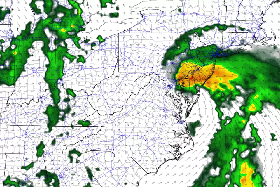
An area of low pressure is currently developing over the Carolinas on this Wednesday morning. Things are getting interesting as it ejects over the warm Atlantic Ocean, as the system becomes more organized and taps into some deep tropical moisture. That will lead to tropical rainfall — the Outer Banks of North Carolina could see 6+ inches of rain in the next day and a half.

As the low tracks northward toward the Jersey Shore, we'll face increased cloud cover and then the threat for heavy rain and wind. We're eyeing the Thursday night to Friday time frame for impacts here in New Jersey.
It's also worth mentioning that there is a chance (60%, according to the National Hurricane Center) this storm develops into a tropical depression or named tropical storm. Fay is the next name on the 2020 Atlantic hurricane list.
Timeline
Unrelated scattered thunderstorms are possible in northern New Jersey Wednesday afternoon. Then we'll experience quiet (although humid) weather for Wednesday night and most of Thursday.
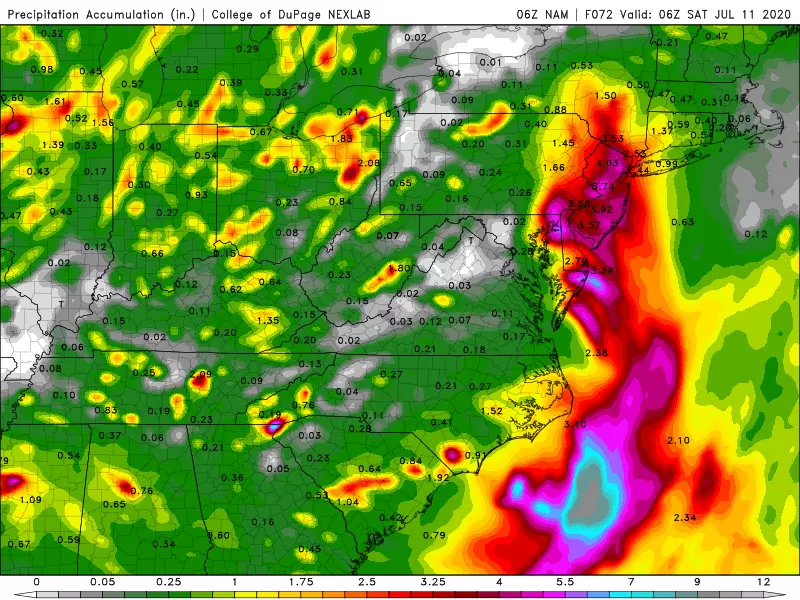
Clouds and rain will start bubbling up from the south Thursday night. (The high-resolution NAM model paints showers over Cape May County around dinnertime Thursday, but I believe that's too fast and too early.)
The storm system's first band of potentially heavy rain is forecast to arrive in southern New Jersey Friday morning, sometime between 2 a.m. and 10 a.m. (I have to give that big start time window, because of the uncertainty surrounding the storm's precise track and extent.)
Friday will be generally wet and unsettled, especially the closer you are to the coast. The best piece of news I can offer is that this storm system will be moving very quickly. So rain should come to an end by dinnertime Friday, setting up a return to quieter weather for the second weekend of July. (Although hot and humid, with scattered thunderstorms.)
Impacts
—Rain... Easily our biggest potential issue here, as the atmosphere will connect this storm system to deep tropical moisture. The rain will be on-and-off — typical of storm systems with tropical characteristics, the rain will push from south to north in stratified bands. Models are pumping out rainfall as high as 2, 3, even 4+ inches, with the biggest totals along the coastline. Yes, we need the rain to stave off drought. But this might be too much too fast, raising flooding concerns.
—Wind... Largely dependent on the ultimate track and orientation of the storm. I could see some gusts in the 30-40 mph range, initially out of the east-northeast. Not destructive, but definitely noticeable and rather unpleasant (especially when it's raining).
—Surf... The ocean will start to churn up Wednesday night. I expect a moderate-high risk of rip currents posted for Thursday and Friday, potentially leading to yellow or red flags flying at the beaches. Current estimates put wave heights up to 4 feet, thankfully not dramatic enough to ring alarm bells about significant beach erosion.
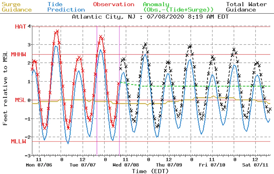
—Coastal Flooding... So far, so good. While there will be a period of strong on-shore (easterly) winds, it will be brief as the storm system flies by. I wouldn't rule out upwards of a foot of storm surge, leading to minor flooding of tidal waterways. Key word: minor.
—Severe Weather... Storms of tropical origin can create wind shear, or different wind speed/direction at different heights. That makes the atmosphere more conducive to severe weather, particularly raising the risk of small-scale wind gusts and tornadoes. Again, we'll especially watch the eastern edge of the state for that potential, as it will end up close to the center of this storm system.
—Other... Humidity levels will be reach downright uncomfortable levels on Friday. And we'll get a break from the heat at least. High temperatures will be limited to the upper 70s to lower 80s because of the on-shore wind, clouds, and rain.
The Bottom Line
This has the capability of being a fairly significant storm system for New Jersey. Our biggest concern is tropical rainfall, which may cause flash or river flooding — one of Mother Nature's most dangerous phenomena. The other impacts I listed will also contribute to a potentially 'yucky' or even nasty day. We'll see how the storm and the forecast continue to develop, before we start to feel those impacts in about 24 to 36 hours. And, of course, we'll keep you updated with the play-by-play. (Next weather blog update scheduled for early Thursday morning.)
Dan Zarrow is Chief Meteorologist for Townsquare Media New Jersey. Follow him on Facebook or Twitter for the latest forecast and realtime weather updates.
More From 94.5 PST